 Three tools available at CourthouseDirect.com are the Tax Map, Tax Record, and the Recorded Plat databases. Accessible from the GIS Map search application, each of these databases is chock full of data and information useful to anyone dealing with real estate.
Buying, selling, or improving land starts with accurate information about the assessed value of the property, whether the taxes have been paid, and the direction, size, and detailed information about the features of the area.
Before looking into these tools, take a look at some of the defining features of each product.

Tax Maps
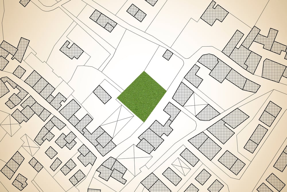
Tax maps are drawings kept by the county recorder for real estate purposes. The maps, also called sheets, do not represent actual property dimensions, but rather a representation of the property.
Tax maps are identified by a Tax Map Number (TMS#) consisting of three parts:
- The sheet or map number
- The block number
- The parcel number
Each map shows several properties at a time. A map may be broken into two to three sections unless the parcels under consideration are too dense.
The block number is shown inside a polygon somewhere on the map. The parcel number is the most specific number on the map and identifies individual properties. The final digits of the tax map number are closely related to the recorded survey from which the tax map is developed. The parcel number is usually shown inside the boundaries of the respective property.
The tax map number is used as a reference when you call into the county offices for information. The tax map is by no means to be used to determine the precise measurements of any plot of land. For that, you need the plat map and survey.
Recorded Plats
A plat map shows the division of a piece of land. If no plat is recorded for a property, it means the area has not yet been platted and will be shown as metes and bounds.
Plats are drawn to scale and serve as the legal description of pieces of real property indicated by lot, street, and block number. The plat also shows the streets, alleyways, easements, and rights of use over a piece of land. Once a plat map is prepared, property descriptions are defined by referring to the appropriate map.
Recorded plats are used for specific properties where the deed assigns a subdivision lot number to each. A plat must be filed with the county for each property subdivided and platted. When you receive a preliminary title report, the recorded plat is included. Plats are highly detailed and show a range of data:
- A precise description of the portion of land.
- The tract orientation displaying the direction of each face of the land.
- Flood zones.
- Easements and rights of way.
- Property lines indicating the exact boundaries of the property.
- Sometimes the square footage of the property.
Recorded plats are used for several reasons. They ensure that public land remains public, and is not encroached upon by private ownership. It shows where the property owner accesses the necessary utilities. And it prevents trespass onto private property by those who don’t have the authority to be there.
Plat maps also ensure that the lots adhere to zoning restrictions and guidelines. If you wish to make improvements by adding structures, the permitting process may require a copy of the plat. Finally, as long as a copy of the recorded plat exists, you are not required to have the properties resurveyed.
However, it’s good practice to have any land you want to buy surveyed in case there is an error in the plat. Many banks and mortgage brokers will not fund a loan if a typographical or other error is present.
You read plat maps according to the various symbols and numbers indicating boundary lines, trees, geography, and utilities. The number and name of each subdivision are available from the county assessor's office. Each lot has a house number and is assigned a parcel number.
Parcel numbers are made up of a book number and page number, both found in the corner of the map. The final part of the parcel number is the number for the individual parcel. These numbers are underlined and set in bold type so you can read them easily.
Each property line is also numbered, indicating the dimensions and general shape of the lot.
Tax Records
Property taxes are ad valorem taxes cities and counties collect to fund schools, libraries, fire departments, and other public services. In fact, property taxes provide much of the revenue for a county or city.
Tax records exist to ensure properties are assessed and taxed appropriately. Typically, a city and county assess properties for taxes annually. However, some areas may do it less often according to local law.
The tax assessor determines the value of a property in one of three ways.
- Sales comparison, also known as the sales evaluation method.
- The cost method, also called the replacement method.
- The income method.
To use the sales comparison, the tax assessor compares the value of a property to similar properties in the immediate area that have recently been sold. The value is adjusted for variables that can add or subtract from a property’s value.
The cost method attempts to calculate how much it would cost to completely replace the structure on a property from the ground up. The assessment includes material and labor while including depreciation for older structures. The value of the land is also included.
The income method is used for business and commercial real estate. It is based on how much income the assessor believes you can generate if the property is rented. The assessment includes the cost of maintenance, insurance, and prevailing rental rates, as well as other factors.
Property taxes are calculated by multiplying the assessed value by the local tax rate. You may hear it called a mill rate, mill levy, or millage rate. One mill equals 1/10th of one cent. You can think of it as one dollar for every $1,000 in valuation.
The tax records show the history of assessments, whether the taxes are in arrears, and the value of the parcel broken down by land and improvements.

Using CourthouseDirect.com’s GIS Tool
CourthouseDirect.com provides convenient access to each of these types of public records. It saves you trips to the county courthouse. It also saves you time. While many of these records are offered online by the county, if you are interested in more than one property scattered over several counties, you would need to access each individual database to obtain your information.
CourthouseDirect.com offers all this information in one place. Registered members can access the GIS mapping tool for free. There is no fee for signing up; you only pay for the product you require. We offer several pricing plans for a variety of needs, from ad hoc access to paying a monthly subscription for a specific number of documents each month.
The tool is simple to use, and you can obtain everything you need to complete a title report, look up leases and acreage for oil and gas work, and find pooling reports. Real estate agents and buyers can see accurate plat maps and look through tax records to identify potentially distressed owners.
For cost-effective access and higher productivity, visit CourthouseDirect.com for these and other helpful tools.