A boundary survey is a method for ascertaining the exact limits of a piece of property. Most homeowners probably have a general idea where their property lines are, but it’s vital to determine where these lines lie accurately before doing any work near the boundaries of a property. Without an accurate survey, you may unintentionally violate your property lines and be held liable for any resulting damages.
Standard Boundary Survey Procedure
One of the main purposes of a boundary survey is to uncover any limitations on the property based on local and state laws. Additionally, boundary surveys will show the extent of any encroachments or easements on the property. An easement, such as a public utility line passing through an area of the property, must be considered so you don’t unintentionally violate it through renovations, landscaping, or any other alterations to the property.
Hire a Land Surveyor
It’s nearly impossible to assess a property’s boundaries accurately without hiring a qualified land surveyor. The correct land survey firm will determine the exact location of your land ownership lines through three phases – research, fieldwork, and reconciliation of the initial research with the results of the fieldwork. When searching for a boundary surveyor or surveying firm, you want to find one with reliable knowledge of the local area and property types nearby. Additionally, if you’re surveying an unusual property type, try to find a surveying firm that specializes in that type.
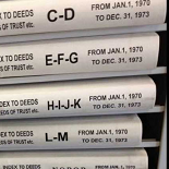
In order to perform a boundary survey, a surveyor must visit the property and examine the historical records related to the property. This typically includes the transaction history for every time the property changed ownership. The more documentation the surveyor has, the more accurate the results of the boundary survey will be. This research allows the surveyor to obtain more evidence of the actual boundary lines for the property, and thus perform a more accurate and legally sound survey.
Establishing a Traverse
Once the surveyor completes the initial research, he or she must take to the field and use specialized equipment to determine the physical limits of a property. The fieldwork aspect of the boundary survey begins when the surveyor creates a network of known points on the property. This control network is the traverse, and it is created by locating known landmarks or other evidence of the property’s boundaries.
Reconciliation
The fieldwork may seem like the most important aspect of the boundary survey, but it is actually only one-third of the whole process. After the initial research and field work, the surveyor will reconcile the collected physical data about the property’s traverse with the records. Once this is complete, the surveyor will supply you with a survey report that not only includes the boundary data, but also what information helped form the basis for those determinations.
Preparation for Your Boundary Survey
It might surprise you to learn you didn’t know exactly where the boundaries of your property are. The accuracy of your boundary survey will largely depend on the volume of documentation about the property and the quality of the surveyor you hire. Hiring a surveying firm is typically inexpensive, so don’t try to skimp when it comes to hiring – a cheaper surveyor may produce a less-accurate report, which can cause significant problems in the long run.
Make sure to properly vet your surveyor by looking for past client testimonials and ascertaining their knowledge about your property location and type. As far as physical preparations go, there are few things you’ll likely need to do to prepare for the survey. If serious vegetation or other aspects of the land impede the survey, these situations are addressed on a per-case basis. When you partner with a qualified and reliable land surveyor, you won’t have to worry about any such eventualities.


