When working in an industry that requires total accuracy and detailed documentation, it’s important to have access to effective and trustworthy tools. Thankfully, CourthouseDirect.com has a number of resources for surveyors to choose what works best for each project.
A Look at Surveyors
The basic surveyor is involved with making precise land measurements to determine property boundaries and provide relevant data to engineers, mapmakers, architects, and construction project managers. According to the Bureau of Labor Statistics, there were 42,400 surveyors in 2012. The industry is expected to keep pace with the nation’s average job outlook, growing by 10% over the next ten years.
3 CourthouseDirect.com Search Tools
While CourthouseDirect.com has a wide array of tools and services, three of them stand out from the rest when it comes to surveyors:
-
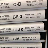
Grantor/Grantee Index: Every surveyor needs access to an accurate and comprehensive Grantor/Grantee Index. This particular index allows surveyors to search for judgments, mortgages, deeds, state tax liens, IRS tax liens, oil and gas leases, mechanic’s liens, and more. To conduct a search, you must specify the state and county you wish to target. From there, you will be presented with a number of available types of searches. Simply enter the details, search and access the report.
-
Geographic Information System: When looking for detailed information, a Geographic Information System (GIS) can help by taking tabular data and tying it to the correct coordinates for spatial display. With this particular GIS, you can connect maps and data such as utilities, satellite images, tax information, deeds and title information. Furthermore, CourthouseDirect.com has a tool for creating quick mailing lists and labels.
-
Geo-Index Title Plants: The third tool can be used to access both current and historical title plants. You can search by section, subdivision, block, lot or survey number. Geographically indexed title plants are available from the 1800s to present day. You can find a variety of information, including grantor and grantee names, adverse liens and encumbrances, deed restrictions, easements, map and plats, starter and bases, probates, and civil records. There are currently 40 Texas counties in the database.


