Technological advances affect every industry. From real estate apps to high-definition scanning in the oil and gas industry, the modern world has a solution for almost any problem a worker might encounter. One such innovation is the drone — a small unmanned aircraft system (UAS). New Federal Aviation Administration (FAA) guidelines came into effect August 29, 2016, that make drone use widely approved and available for commercial applications.
Surveying Work and Drones
Drones open the door to a wealth of opportunity. Thanks to the new FAA rules, surveyors can now conduct their duties remotely and indoors. The surveyor uses a remote monitor that gives a view of the building as seen by the drone. Clients and property occupiers can view the monitor with the surveyor from inside at any time. This eliminates a variety of health and safety hazards, and makes the surveying process faster and easier.
Surveyors can redirect the drone’s flight path or extend the survey if an unexpected element arises that is only visible from the air. Drones are easy to dismantle and reassemble at other nearby properties, making it convenient and cost-effective for surveyors to perform more than one survey on a single visit without wasting time. The only thing that may deter the use of a drone for surveying is inclement weather. Strong winds or heavy rain may blur the video image or send your drone off course.
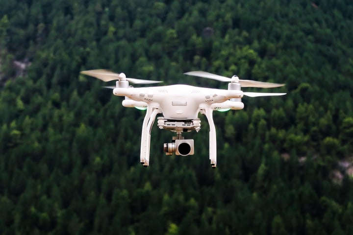
There are two basic types of drones used by surveyors: fixed-wing units and a rotor-type. The fixed-wing unit uses one brushless electric motor, while the rotor-type has between three and eight brushless electric motors. Both types of drones rely on featherweight lithium polymer batteries that store a great amount of power. The brushless motors have a wide speed range for various types of flight. The lightweight frames and digital cameras make these drones relatively low cost. New technology enables the drones to land automatically, return to base when the battery is low, and hover if a signal is lost.
How to Get a License to Fly a Drone
The Civil Aviation Authority (CAA) requires minimum standards for surveyors and others to fly a drone for commercial purposes. The requirements can seem daunting, but they are well worth the advantages of using a drone for surveying activities.
Here are the CAA requirements:
- Pass a theory exam. The CAA theoretical knowledge exam asks core subject questions related to the level of license for which a surveyor is applying. It also may ask questions specific to the type of flying you plan to do — in this case, flying a drone. You may take the exam upon recommendation from an approved training organization and after completing the appropriate training course of theoretical knowledge. A score of 75% or more is required to pass the exam.
- Take the practical flying test. A number of organizations offer the practical flight exam for commercial drone use. Make sure the enterprise you choose is CAA-approved for drone pilot training and assessment. During training, you will learn how to operate the drone. You must demonstrate your knowledge during the practical flight exam. You will be scored based on real flight performance.
- Develop basic procedures for the type of flying you want to do and create an operations manual. The development of your manual will be unique to your company. The CAA must approve your organization’s manual in order to give you final permission to operate a UAS.
Should You Consider a Drone?
Many surveyors use drones following the FAA approval for commercial use. Surveyors are discovering how easy it is to obtain clear, accurate measurements and images of a property from a remote setting, all with the push of a few buttons. New drones allow surveyors to upload Google Earth data to map flight path coordinates and create automatic flights for more efficient surveying. The pilot can change the angles of the cameras in real time, and look through the drone’s lens using a video headset — providing a view as though the surveyor was flying inside the drone.
Drones are more affordable today. A high-quality drone controlled via GPS and with a camera costs less than $6,000. In the future, we may see real-time 3D imaging from drones and other clever innovations. The FAA is developing rules for commercial drone use to solve problems of safety and privacy associated with UAS. Stay current on the rules for using drones for surveying and other commercial endeavors to make sure you are operating within the law.