
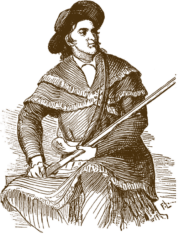

"I must say as to what I have seen of Texas it is the garden spot of the world. The best land and the best prospects for health I ever saw, and I do believe it is a fortune to any many to come here.
There is a world of country here to settle."
- Davy Crockett, 1836.

The 268,820 square miles which now make up the state of Texas have seen centuries of shifting borders, changing governments, and competing claims. Each governing nation and each wave of settlers left its impression on the complex history of Texas land, and the role public records play in today’s Texas is directly tied to that legacy.
It’s worth taking the time to sift through the history: after all, the best way to understand where you’re going is to know exactly where you began. To make it easier on you, we’ve put together the story of the last 500 years of Texas land in one simple-to-digest guide. This resource traces a bright line from the very first land grants ever issued here to the creation of the General Land Office and on to the ways that new legislation and technology are shaping the way we keep public records today.
The land we call Texas today has a very different shape to the tracts claimed by the first non-indigenous settlers. Pre-European Texas, before it held that name, was a place with no official borders, home to a shifting mosaic of native civilizations with their own rich histories and traditions that were deeply tied to the land. The modern concept of private and public land ownership only began with the arrival of the first European colonial forces. Over a period of more than 300 years, Spain and Mexico each left their mark on the way public land was recorded and distributed. By the time Texas became a republic and then achieved statehood, the system we know and use today was largely in place.
The Spanish were the first Europeans on Texan soil, and the first to issue public records regarding the land. Spain gave Texas its name: Tejas, a word from the Native American Caddo language, meaning friend or ally. There are only about 60 land titles of note remaining from the 130 years that Spain formally controlled Texas. Titles granted directly from the King of Spain were rare for a number of reasons:


Those land titles that still exist from the Spanish period are measured in varas (Abbreviated as “vr.”, or plural “vrs.”.) This unit of measurement was eventually adopted by the state of Texas as its official land measure, and may can (I still run into things measured in varas that were filed in the last 50-100 years) still be encountered in some land transactions today. Over time, the exact size of a vara was standardized. When looking at land titles from the early years, you’ll often run into this unit of measurement, as well as two more, the league and the labor.
While the early years of Spanish rule were sparse in terms of public records, a few key events got the ball rolling on land distribution and policy in Texas.

1519 - Spanish explorer Alonzo Alvarez de Piñeda is the first European to set eyes on the gulf coast. There’s no evidence that he ever actually stepped off his ship onto Texas, but he claimed the land for Spain and produced the first public document relating to this area: a map of the territory (which is now housed in Sevilla, Spain.)
1685 - France takes an interest in the area, which had been more or less ignored by Spain for over a century, and establishes a fort at Matagorda Bay, claiming the territory for themselves. Spain is informed of the French “invasion” and tries to take action, but it takes 10 separate expeditions for them to find the fort. The French colony is in tatters and willingly surrenders the land back to Spain.
1690 - The Spanish know they need an established presence to protect their claim, but volunteer settlers are hard to come by: Texas is dangerous and unknown, and there’s plenty of land to go around in the established Mexican colonies. The task falls to missionaries, and the first mission, San Francisco de los Tejas, is established (on the San Pedro Creek just east of the Town of Augusta in Houston County).
1720 - The date of the earliest known surviving land title in Texas, granted to San Antonio’s San Jose Mission. The document is now carefully preserved in the Texas General Land Office.
1767 - Commissioners arrive from Spain to hand out tracts of land to loyal settlers who have endured the deprivations and dangers of the frontier. These lots, called porciones, were long and narrow, usually fronting on a waterway.
1793 - Some of the more wealthy settlers have the opportunity to purchase huge tracts of royal land around the north shore of the Rio Grande. The largest of these was the “San Juan de Carricitos” title, 601,657-acres which were titled to José Narciso Cabazos.
1820 - Previously, land grants were only available to Spanish subjects, but at this point the government opened up opportunities for foreign settlement, including Anglo-American pioneers.


1821 - Former Spanish subject Moses Austin, formerly of Louisiana, is the first to gain permission for Anglo-American settlement, and is issued an empresarial land grant: the 300 Anglo-American families he brings to Texas are to be given tracts in return for working the land, promising to follow the Catholic faith and offering loyalty to the King of Spain. Austin dies before the plan can be put into action, and Mexico’s declaration of independence from Spain means that Texas suddenly becomes a Mexican province.

The imprint of Spanish settlement and land policy remains relevant to this day. Spanish land titles from this period are still legally recognized, and four million acres of land in Texas today derive their title from the original Spanish land grants. The Spanish influence can also be felt in the many laws from that time which still impact the way property is handled today:
Mexican independence didn’t stop the Anglo-American settlement of Texas or the rapidly growing prevalence of official land titles. The new Mexican empire was concerned about keeping the United States at bay, and knew that strong colonies were the best way to support their claim on the land. The foreign settlement legislation from this period was generous, and contributed to the rapid population growth of the area. These laws included:
In 1823 Stephen F. Austin (having inherited the original Spanish empresarial land grant from his father) lobbied hard with the new Mexican government. Due largely to his influence new legislation was introduced to welcome the 300 families (known as the “Old 300”) to the area (between the Brazos and Colorado Rivers that now spans 19 different Texas Counties) . The law only lasted long enough for this one colony to be introduced, but the repercussions of that settlement continue to be felt in Texas public records today.

The brief rule of the Mexican Empire ended when it became a Federal Republic in 1823. This was a big moment for Texas, as the new government decided to combine the two provinces of Coahuila y Texas into a single state. A year later, the republic readdressed the question of land settlement with a new law.
In response, the state of Coahuila y Texas introduced its own legislation.
This is by far the most influential public land legislation of Mexican Texas. A huge majority of land titles from the Mexican period were issued under this law, and the resulting explosive growth of immigration by Anglo-American settlers was to become an inciting factor in the Texas Revolution.

Thousands of titles were issued in a short span of years, and thanks to these extremely generous terms and policies, by 1829 Anglo-American settlers outnumbered Mexican Tejanos at a rate of 10 to 1. Tensions had been rising, small rebellions of American settlers against local governments were erupting, and the very real fear was that Mexico would lose control of Texas to the United States. In response, the Mexican Congress enacted a new law.
The colonists were furious to be cut off from friends and family, and enraged by the new enforcement of customs duties. Many slaveholders also chafed against what they saw as the restrictive limitations of Mexican anti-slavery laws. On October 2, 1835 with the invitation to, “Come and Take It” and a cannon blast the Texas Revolution was under way. Settlers set up a provisional government in Harrisburg, Texas now present day Eastern Harris County. After a 6th month, “Runaway Scrape” led by General Sam Houston ended with the capture of General Santa Anna on the banks of the Buffalo Bayou, the Mexican government conceded it had lost control, and the independent Republic of Texas was born.

Mexico’s legacy in modern-day Texas is still easy to see. Like Spain, they left behind property policies and laws which reach into current legal practice. Mexico also pioneered the idea of selling off public land in order to raise urgent state funds, a practice that would have a lasting impact on Texas history. Titles that were issued by the Mexican government before November 13th 1835 are still recognized today: together, these titles address a whopping 22,000,000 acres.
The history of Texas independence and eventual statehood is well-trodden ground, but one overlooked aspect is the deep influence left by early decisions on land policy. Within a year of the Republic’s birth, Texas established the General Land Office (GLO) in Austin, the same institution which still governs Texas land management and rights today. The fact that the new Texan government made land rights such an immediate priority says a lot about how central the issue is and was to the Texan ethos and identity. More than 35.5 million records and 45,000 maps are now housed in the GLO, providing an invaluable resource to historians, landmen, surveyors and genealogists.
Important dates regarding land records in this period:
1835 - In anticipation of the upcoming revolution, all local land offices are closed by the Texas provisional Government.
1836 - The independent Republic of Texas is formed.
1837 - The General Land Office is created, and John Borden is appointed the first Land Commissioner. He immediately takes up the task of collecting and recording all legacy Spanish and Mexican land grants and titles.
1838 - The GLO establishes eleven local land districts to administer land certificates. The original district offices were:
Each district has a dedicated surveyor and Board of Land Commissioners. Their job was to consider headright and pre-emption claims and issue land certificates from the GLO, as well as collecting fees.
1845 - Texas is admitted into the Union, achieving full statehood. Upon annexation, Texas retains control of all its public lands from its time as a sovereign state, something unique in the history of the U.S. To this day the only federal lands in Texas are a result of either purchase or donation.
1846 - Arguments with the Mexican government over disputed borders launch the Mexican-American war.
1848 - The Treaty of Guadalupe Hidalgo ends the war. Mexico grants the U.S. undisputed control of Texas and the Mexican Cession—529,000 sq. miles of what is now the American Southwest—in return for US $18,250,000.

1850 - The current boundaries of the State of Texas are set in the Compromise of 1850. Texas cedes its claim to land which will eventually become parts of modern New Mexico, Colorado, Kansas, Oklahoma, and Wyoming. In return, Texas is granted US $10,000,000 in federal bonds, a relief from the old Republic’s enormous debt.
1861 - Texas joins the Confederate States of America. The Civil War would have its impact on Texas land records as Confederate Scrip land grants were issued to permanently disabled Confederate veterans or the widows of Confederate soldiers killed in action.
Land administration in these years took on a new level of organization

"I’ve traveled all over the world, but I don’t
think there is any place better than Texas."
- Red Adair

and efficiency. The district land commissioner offices were in regular contact with the General Land Office, and the process for all new land grants was as follows:

"At 268,596 square miles, Texas is the second largest state behind only Alaska. With 25.1 million people, according to the 2010 U.S. Census, it is the second most populous behind only California."
- History.com


Land grants during this period of time fell under three main categories:
Headright grants were created to encourage immigration after the establishment of the Republic, and later statehood, though they were (unsurprisingly) not available to Native Americans or African Americans. They also served to standardize and organize the various squatters and usage rights that had been established under the governments of Spain and Mexico.

The tradition of awarding land to loyal soldiers was active throughout the tumultuous early years of the Republic and state of Texas. Military service land grants included:


"Texas is neither southern nor western. Texas is Texas"
- Senator William Blakley

Both the Republic and the state of Texas regularly promised land against debts and sold public lands to raise money for war and for internal improvements and infrastructure. Scrip was given in lieu of cash to contractors and investors, and it was issued to private individuals, contractors and corporations. Schools, railroads, ships and steamboats, irrigation canals, factories and harbor development were all paid for by the sale of public land. (Note: the current capital building in Austin was built by Charles B. and John V. Farwell in exchange for 3 million acres of land that covers 17 counties spanning from Dallam County south to Cochran County, east to Lubbock County and north to Sherman County.)
The great era of unappropriated public domain lands ended in 1894. The Texas Supreme court, in the case Hogue v. Baker, declared that there was no more vacant and unappropriated land in the state. In the year 1900, an act was passed that set apart the very last vacant land in Texas to be used for the benefit of the state’s public school system. See these articles for a current State vs Federal fight re: public domain lands and the school system here.

In spite of the constant prodigious record-keeping work of the General Land Office for over 175 years, the keeping of public records has not always run smoothly. Once land passed into private ownership, future record keeping, including deeds and mortgages, passed into the hands of the counties. There are now 254 counties in Texas, but that wasn’t always the case. The original 23 counties were divided and subdivided over time, and the legislation and organization of new counties proceeded in fits and starts. Some counties were created out of other counties and some simply ceased to exist. The paper trail for these “extinct” counties can be confusing, with records being absorbed by neighboring county courthouses, or in some cases simply going missing. With only a few exceptions, county lines were more or less fixed by 1900, so these problems usually only arise in cases where very early records are required.
In 1972, the Texas legislature undertook a statewide records preservation reform, with a unified system of depositories for important public records. The Local Records Division of the Texas State Library now collects and stores public records in the following depositories:

These collections are available to the public, but generally only by interlibrary loan. Some have been microfilmed, but many others have not.

Natural and manmade disasters have played their part in the history of Texas public records. Over the years, thefts, hurricanes, floods, and fires have all taken a toll. Dozens of county courthouses suffered partial or complete loss of records, often at the hands of an arsonist. Some of the most notable disasters included:
Galveston County Courthouse: Completed in 1861, the courthouse had been built with the revolutionary use of fireproof cast-iron, especially to protect against the loss of records in a disaster. This forward-thinking certainly came in handy during the Galveston Fire of 1895, but five years later the flood waters of the Galveston Hurricane of 1900 destroyed everything. A few county records survived in a vault, and sometimes neighboring counties may have duplicate records, but for the most part everything from before 1900 is gone.
Hardin County Courthouse: Burned in 1886, many early county records were destroyed, including surveyors’ and probate records. A few records survived in an iron safe.
Hopkins County Courthouse: A huge fire in 1894 destroyed the courthouse, the county jail, and several nearby buildings. Almost all the records were saved, with the exception of some stored in a judge’s office.
Llano County Courthouse: This beleaguered courthouse (well, a series of courthouses) has suffered five separate fires in its history, and records were lost in each instance.
1873 - The courthouse burns down, along with many county records.
1880 - The rebuilt courthouse is burned to the ground again in a fire which consumed the office of the district and county clerk, containing all the county records.
1892 - The new courthouse built in 1885 is again destroyed by fire. The clerk’s office papers and records were the only county records saved.
1932 - Yet another fire damages the tower and parts of the interior of the Llano County Courthouse, built in 1893.

1951 - The courthouse is burnt down one more time, and the county’s remaining oldest records are destroyed.
Tom Green County Courthouse: Both flood and fire devastated the county records at separate times. In 1882, a flood destroyed the county seat, with the loss of many early records. Four years later, in 1886, a fire (blamed on mice eating matches) begins in the office of the Clerk of District Courts on the second floor of the courthouse. Many public records are consumed in the conflagration.

Changing legislation at both the federal and state level have revolutionized the keeping and availability of public records in Texas at various points throughout its history.
In 1966, President Lyndon Johnson signed the Freedom of Information Act (FOIA) into law. The FOIA was an amendment to an earlier act, designed to foster "a general philosophy of full agency disclosure." The main requirements of the law are:
Information on how to submit a request for public records under the FOIA can be found on the FIFA Online website.
Changes in the way information and records are stored necessitated the update of the FOIA to directly address electronic records. In 1996, The Electronic Freedom of Information Act Amendments stated that all agencies:

While the Federal FOIA had wide-ranging consequences throughout the country, in its wake several individual states passed their own analogous laws. In Texas, the development and enactment of such laws was especially dramatic, spurred on by a momentous scandal and its backlash.
The Sharpstown Bank Fraud Scandal of 1969 saw federal accusations and later state charges brought down on an astonishing number of Texas state officials: nearly two dozen current and former officials were involved. A case of corruption, bribery, and stock fraud centered on the former state attorney general Waggoner Carr, former state insurance commissioner John Osorio, and Houston businessman Frank Sharp. The scandal also implicated Governor Preston Smith, House Speaker Gus Mutscher, Jr., his aide Rush McGinty, state Democratic chairman and state banking board member Elmer Baum, Representative Tommy Shannon of Fort Worth. Mutscher, Shannon, and McGinty were eventually convicted on felony charges, and in the resulting public uproar (just three months before primary elections) more legislative seats were up from grabs than at any time since the Second World War. Fresh candidates arrived on the scene under the banner of “throw the rascals out.”
After a thorough housecleaning, the new government began the implement sweeping reforms which gave birth to one of the country’s most comprehensive Open Records Laws. The Texas Public Information Act was codified at section 552.001 of the Government Code. It was signed into law by the Texas legislature in 1973. The nononsense preamble makes the mood of the act very clear:

An extremely important case in the general history of land rights was Morris v United States 174 U.S. 196, which was decided by the Supreme Court in 1899. The main conflict in the case centered around new land that had been created on the bank of the Potomac River.
Not long after the District of Columbia was created, the Federal government sold several nearby plots of land which fronted the Potomac to private individuals. In 1882, the Potomac River was dredged, and the materials were used to backfill swamps and shores along the riverbank. These works created a substantial amount of brand new land, much of which adjoined the privately held properties and cut off their access to the river. Congress passed legislation in 1886 telling the Attorney General to protect the Federal Government’s interest in these new lands. In response, the heirs and other claimants sued the United States for title.
In spite of fierce arguments from the private heirs (which invoked land grants and border disputes between Maryland and Virginia going back to the 17th century) the Supreme Court ultimately found in favor of the United States. The decision stated that the original landholders had held the land of the riverbed in trust, and that at the time of the Revolution that public trust was passed on to the state.
The Morris v United States decision was extremely influential in the development of land law, because it formally established the precedent that bodies of water and their beds were common property, held in trust by the state for the public. As the importance of mineral rights developed, this precedent was to take on new significance.

Before anyone knew about the valuable mineral and oil resources which lay beneath many tidelands, the submerged territories of coastal states were not generally given much thought. The United States Constitution is silent on the question of ownership: does control of these lands lie with the Federal government or with the individual states? The issue rose into public consciousness after the first costal oil wells began springing up in the late 1930s.
In 1946 the Federal government filed a lawsuit against the state of California. United States v. California, 332 U.S. 19 claimed that the US government was "possessed of paramount rights in, and full dominion and power over, the lands, minerals and other things underlying the Pacific Ocean lying seaward of the ordinary low-water mark on the coast of California, and outside of the inland waters, extending seaward three nautical miles . . . ." In 1947 the United States Supreme Court upheld that claim: a decision that raised strong objections from other states.
By the time the 1952 Presidential election came around, the issue of tideland rights was a hot topic. Dwight D. Eisenhower made a campaign promise to restore these rights to the states, and in 1953 that promise was fulfilled by the Submerged Lands Act, which granted individual states the title rights to all natural and mineral resources within three nautical miles of their coastlines. This legislation was accompanied by the Outer Continental Shelf Lands Act which granted Federal jurisdiction over submerged lands beyond that border, and gave the Secretary of the Interior authorization to lease those lands for mineral development.
The legislation was popular but far from perfect, and it sparked off years of administrative and financial headaches, as well as intense litigation. All of five the Gulf states (Florida, Texas, Louisiana, Mississippi, and Alabama) were involved in lawsuits with the Federal government over the actual tidelands boundaries. In 1960, the Supreme Court ruled in the landmark cases of United States v. Florida, 363 U.S. 121 and United States v. Louisiana 363 U.S. 1, answering once and for all where the tidelands boundaries lay for (nine nautical miles.) The Supreme Court recognized that this boundary had been recognized by Congress back in 1848 in the Treaty of Guadalupe Hidalgo, the document which ended the Mexican-American War.
The idea that a Texan home should be immune from seizure by creditors dates back to the legislature of Coahuila and Texas, which passed a decree to this effect in 1829. While that decree was later repealed, it was the model for the original Texas Homestead Act, which was signed into law in 1839.
The Homestead principle was fully embodied in the Texas Constitution of 1845. It’s been a part of every constitution since, and today Texas Homestead rights are some of the strongest and most generous in the country. Enshrined in article 16 of the current Texas Constitution and further legislated in 41.001 of the Texas Property Code, these rights and protections offer tax breaks and other benefits, but most importantly, they shield the property from seizure by general creditors. This immunity isn’t universal: property designated (and occupied) as a homestead can still be reclaimed under a mortgage or pre-existing lien or a debt owed to the Federal government, but it cannot be subject to forced sale otherwise.
There is no limit to the property value of a homestead in Texas, only to its size. Homesteads are designated as either rural or urban, which determines the maximum size of the protected property. A rural homestead is limited to 100 acres for a single adult or 200 acres for a family, while an urban homestead is limited to 10 acres. A homestead is considered urban when:
Texas homesteads are achieved through natural use, and there are no specific documents, legal actions or other recorded claims necessary to designate a property as a homestead. The owner simply needs to both use and intend to use the property as a homestead.
Once the property has been established as a homestead, there are three ways it can lose that status:

Homesteads can be held as private or community property. The spouse of the owner must be party to any transfer or encumbrance of the property, and either spouse must have the consent of the other to effect an abandonment of the homestead. In the case of a divorce, the property will not lose homestead status as long as one of the partners continues to use it as a main residence.

“The people, in delegating authority,
do not give their public servants the right to
decide what is good for the people to know
and what is not good for them to know.
The people insist on remaining informed
so that they may retain control over the
instruments they have created.”


The way public records have been kept has changed drastically since the days of fountain pens and parchment. Each step forward in technology has advanced the clarity and longevity of records, and increased their availability to members of the public. These technologies have paved the way for a new era of transparency and engagement. They’ve enabled the growth of industries and have made life a lot easier for both clerks and citizens.
The development and growing availability of film and photographic technology in the early 1900s was the first “great leap forward” for the keeping, archiving, and distribution of public records. Instead of laboriously producing a limited number of copies by hand, clerks could take film pictures of each page of a document. The originals were carefully filed away, and the pictures made available for public examination.
The sheer volume of public records generated by any government office is overwhelming even before you consider duplication. The advent of micrographic technology made it possible for vast amounts of textual and visual information to be shrunk down, usually to 1/25 of the original size. The film was stored either on rolls or reels (microfilm), flat sheets (microfiche), or on aperture cards (a punched card with chips of microfilm, often used to create multiple inexpensive but archival-quality copies of documents). The ability to easily create copies made it much easier to conduct record searches and to make records available to multiple individuals or organizations at once.
When computers came on the scene in the 1980s and 1990s, they fundamentally changed both the way records were generated and how they were stored. Now records could be quickly distributed through rapidly printed copies or on disks, and it became much easier to keep vast quantities of records safely in multiple locations. Scanners made it possible to digitize and archive even the oldest records. As processing power and disk space have continued to increase (and purchasing costs drastically decreased) the ability to store, search, and analyze huge amounts of data is commonplace.
The Internet has totally transformed the availability of public records. Anyone with a mobile device now has instant access to countless resources, full of public records dating back to America’s earliest days. More and more state offices and libraries are digitizing and putting their entire archives online. This totally accessibility allows researchers to find almost any record, any time, from anywhere.

Land has always been central to the American identity, and that might be truer in Texas than anywhere else. Public records have always been vital to establishing who held the right to a specific patch of ground: it was true in the time of the earliest settlers, and it’s still as true today. These records are an incredible valuable resource: they are one of our strongest links to the past, and continue to underpin the way we think about and deal with property from the family home to the vast reaches of an oilfield.
The history and background we’ve gathered here is only the beginning of what these records have to offer. From academic researchers to amateur genealogists, from professional landmen and surveyors to family historians, anyone who digs into these records will be rewarded. If you’re interested in this rich vein of information, CourthouseDirect.com should be your first stop.


“You may all go to Hell,
and I will go to Texas.”
- Davy Crockett
